Why LandSight Drones?
LandSight Drones delivers high-resolution aerial data and thermal imaging to help you spot issues faster, boost safety, and make better decisions. Our team specializes in automated drone mapping and inspections for construction, real estate, energy, public safety, and more—powered by FAA-certified pilots.
Explore Our Capabilities
Thermal Imaging
Night & Low-Light Operations
High-Resolution RGB Camera
Pinpoint heat loss, hotspots, leaks, and hidden anomalies using high-resolution thermal imaging. Perfect for inspecting rooftops, fields, and infrastructure with precision and speed.
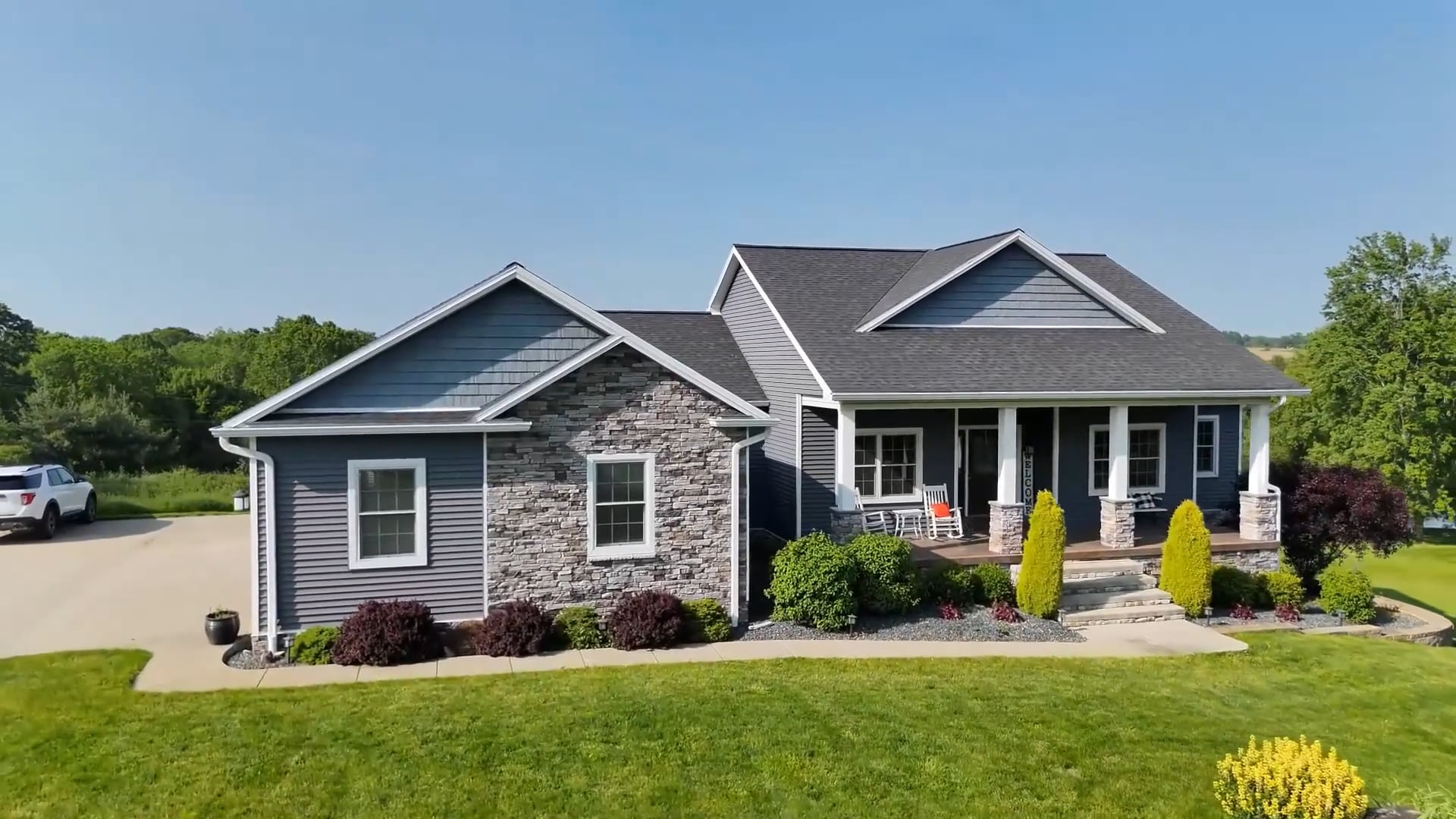
High-Resolution RGB Camera
Night & Low-Light Operations
High-Resolution RGB Camera
Capture crystal-clear aerial visuals for inspections, progress tracking, mapping, and marketing. Our high-resolution RGB cameras ensure every detail stands out.
Night & Low-Light Operations
Night & Low-Light Operations
Automated Mapping & 3D Modeling
Conduct safe and effective flights in low-light or nighttime conditions using thermal sensors, high-res imaging, and an onboard spotlight for targeted visibility.
Automated Mapping & 3D Modeling
Automated Mapping & 3D Modeling
Automated Mapping & 3D Modeling
Generate detailed orthomosaics, elevation models, and 3D reconstructions for planning and analysis. Fast, accurate, and powered by automated workflows and thermal overlays.
20× Hybrid Zoom Capability
Automated Mapping & 3D Modeling
20× Hybrid Zoom Capability
Inspect towers, rooftops, and tight spaces from a safe distance—no ladders, no lifts. Our zoom tech and thermal imaging let you evaluate hard-to-reach assets with total confidence.
Explore Industry Solutions
Automated Mapping & 3D Modeling
20× Hybrid Zoom Capability
Subscribe
Stay ahead with the latest in aerial surveying technology, exclusive service discounts, and valuable insights to help you manage your land, crops, and projects more efficiently — join our mailing list today!
This website uses cookies.
We use cookies to analyze website traffic and optimize your website experience. By accepting our use of cookies, your data will be aggregated with all other user data.